I already went over the Casey Emergency Airstrip domestic site in a previous blog post, but wanted to do a similar blog post regarding the other air photo I purchased from the National Air Photo Library.
I've been to Casey on two occasions, so this post is built on what I saw on the ground, as well as what I've put together from air photos, satellite photos, the site plan for RCAF Station Casey that Dave St-Laurent acquired from the National Archives, and some common sense derived from how other bases and stations of the time have been laid out.
From the best of my understanding, the airstrip was requested by National Defence to be built by Transport Canada, in support of the Pinetree Line project, like many other emergency airfields across Canada. I have a document that proves that much. Then, it seems from air photos at the National Air Photo Library, that the initial construction of the airstrip didn't have the alert apron, but by 1964 it did. Does this indicate a 2nd phase or upgrade? Or was the first air photo I saw just mid-construction? I'm unsure, but I believe the airstrip was upgraded in the late 1950s to accommodate emergencies with larger planes, like the B-52, rather than just air-defence interceptors like the CF-100, as I believe they had originally intended.
Dave St-Laurent retrieved from the National Archives a site plan showing a further planned expansion, but I'm unsure of the date it was drafted up. One of the other documents I found shows that further expansion of the Casey air strip (to be called RCAF Station Casey) couldn't proceed because they couldn't find sufficient solid ground to put the buildings. If you've been there, or look at a topographic map, you'll see the area is very swampy. Luckily the site plan for the expansion shows the names and types of buildings that were already there, as well as showing what they planned to add. This really helps decipher the air photo from 1964.
The full resolution TIFF image can be downloaded
here (over 100Mb) so you can draw your own conclusions.
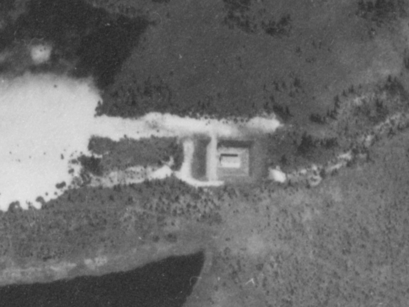 |
| "U/S Explosives Storage" per Site Plan |
I originally thought the label of "U/S Explosives Storage" on the site plan meant United States Explosives (aka Ammo) Storage... but I now think this was for "
Un
Stable" explosives, maybe dynamite or other such explosives that would have been used to construct the airstrip. The location is over 500 meters from the runway, which I presume isn't a coincidence. The same temporary structure on a cement pad with high berms around it could have been used for ammunition if a plane made an emergency landing and needed to offload munitions.
 |
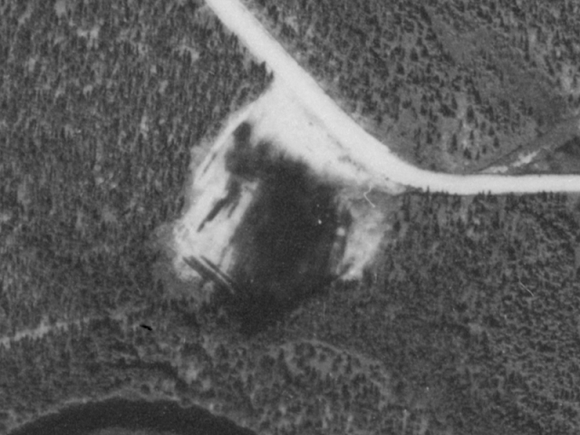
| Control Tower and Bridge |
It isn't clear to me what the other buildings are in this photo, but the control tower is clearly visible.
 |
| "Gravel Pit" per Site Plan |
In the proposed site plan the above was shown as a "Gravel Pit", right near where the future PMQs would be, as well as a drill hall and churches.
 |
| "Old Borrow Pit" per Site Plan |
I was not familiar with the term "Borrow Pit" but after looking it up, it makes sense. I walked along the trail (shown) that goes from the runway to the NW of the picture in 2012; while quite overgrown it is passable. Walking back, through the bush rather than the same trail, I didn't notice anything unusual, the area was relatively flat, had lots of trees, shrubs and moss, and no hint of what it had previously been used for.
 |
| "New Borrow Pit" per Site Plan |
This "New borrow pit" I didn't actually get to when visiting the Casey air strip, the woods are pretty dense around there. I guess this would have just been where clean fill would have been taken from to fill in where other uneven areas were, probably to do with the construction of the alert apron, I would guess, based on proximity.
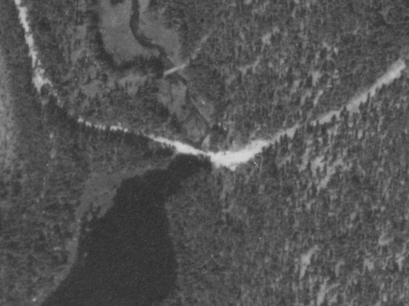 |
| Bridge , which isn't there anymore |
Centered in the middle is where a bridge used to be, but has been washed away over the years. The lake comes to a pinch at that spot and the crossing doesn't look to me to be possible in an ATV. Either side is too steep, and the water looks deep. The picture makes it look like the bridge may have been a dam; I'm not sure, since it has all been washed away.
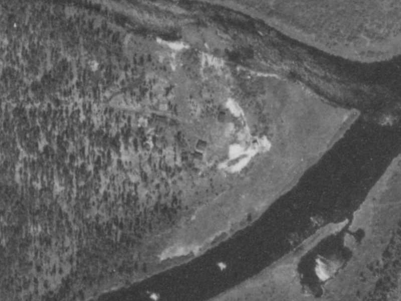 |
| Water well and supporting buildings |
The site plan explained what this cluster of buildings above are; it's where the fresh water well that the domestic site drew water is located. I'm unclear how many buildings were there, and how it was powered, but I see at least 3-4 buildings - perhaps they had their own generator to power the pumps? Due to the aforementioned bridge being gone I didn't make it there.
 |
| Remote RX Site for VHF and UHF |
The site plan clarified that this site is the remote VHF/UHF receiver site for the air strip.
 |
| Remote TX Site for VHF and UHF |
The site plan clarified that this site is the remote VHF/UHF transmitter site for the air strip.
 |
| Alert Apron with space cleared for Alert Hangers |
This space looks like it was made for upcoming development, it was where on the site plan alert hangers were supposed to be built, and makes sense since the alert apron was constructed there. Perhaps the plan had been underway to upgrade the Casey site when the plug was pulled because of a lack of solid ground. I dont have a date for when the Casey Air Strip was officially decommissioned, or the buildings which were there were razed, but it would have clearly been after this picture was taken in 1964.
On the RCAF Station Casey site plan (never completed) the buildings were described in the following manner. Their labels on the map sometimes were slightly different.
| No. | Builidng Type | Building Reference |
| 1 | Headquarters | S14-1016 |
| 2 | 8 Bed Hospital | S15-1013 |
| 3 | Control Tower | S42-1002 |
| 4 | Central Heating Plant | S23-1019 |
| 5 | Ration Depot | S17-1002 |
| 6 | Supply Depot | S17-1003 |
| 7 | 12 Bay M.T.Garage | S32-1011 |
| 8 | Bulk Fuel Storage | C57-21-1000 |
| 9 | Electric Power Plant | C57-22-1001 |
| 10 | Combined Mess (300) | S31-1030 |
| 11 | Officer's Quarters | S30-1030 |
| 12 | O.R.Quarters | S30-1030 |
| 13 | O.R.Quarters | S30-1030 |
| 14 | O.R.Quarters | S30-1030 |
| 15 | O.R.Quarters (Future) | |
| 16 | O.R.Quarters | S30-1030 |
| 17 | (not allocated) | |
| 18 | Sewage Disposal Plant | C57-24-1001 |
| 19 | Main Supply Pump House | C57-25-1000 |
| 20 | Explosives Store | S20-1015 |
| 21 | Water Reservoir | C57-25-1001 |
| 22 | Well Pumphouse | |
| 23 | | |
| 24 | | |
| 25 | VHF/UHF/ADF | S13-1000 |
| 26 | | |
| 27 | VHF/TX Remote | S13-1037 |
| 28 | VHF/RX Remote | S13-1037 |


No comments:
Post a Comment